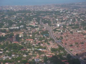
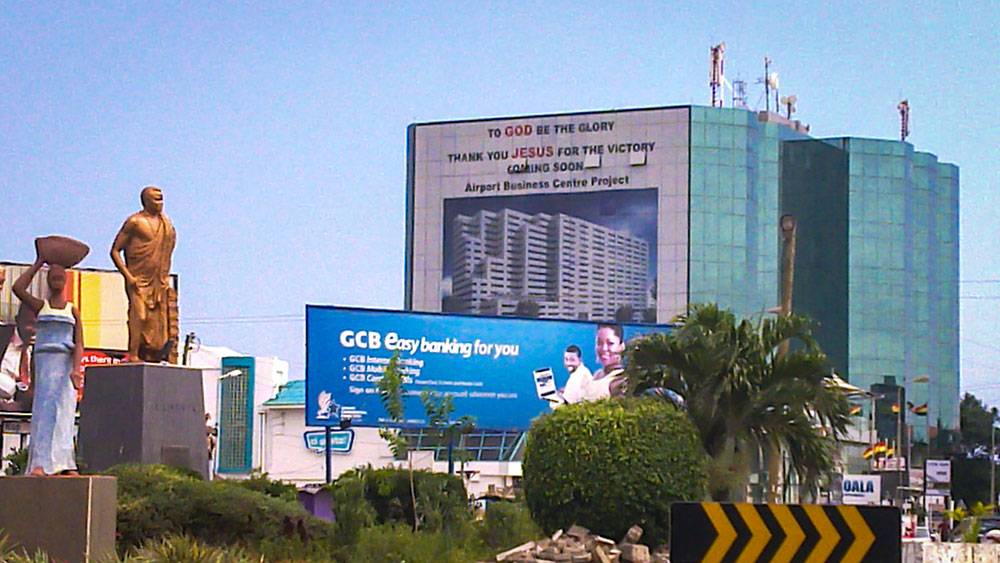
Like many African countries, Ghana has grown rapidly in recent years, with new buildings almost appearing overnight. Birendra Sasmal, CEO of Subah, explains how technology has been used to carry out the largest mass household data collection and building mapping exercise in African history.
Understanding and documenting the new world is a huge challenge for all types of organisations in Ghana.
The Government needs to provide municipal services, including roads, schools and medical facilities and wants to apply property taxes to maximise its revenues.
After a comprehensive consultation with the Government and other key stakeholders in Ghana, Subah Geospatial – part of the Subah Group – was set up in 2014 with the specific goal of identifying and recording all the streets, buildings, businesses and people in urban Ghana.
“We found that we should have an innovative solution in which we can address each house in Ghana so that we can give better services to people and the Government and communities can benefit from it,” said Sasmal.
“We are constantly looking for new ways to help solve real problems found in Africa. This project is a massive undertaking involving the development of new platforms and a huge time commitment.
“However, even before completion, the data is being used to improve the working and personal lives of Ghana’s citizens.”
The mapping and household data gathering exercise – which is set to be completed by June – will include all the metropolitan and municipal areas in Ghana, which make up about 62% of the built-up land mass.

The features being recorded are:
- Building and property shells
- Street centrelines
- Key landmarks and point of interests
- Cartographic features traditionally included in maps such as rivers, wetlands, political boundaries and county limit
- Household information
The process
The information gathered from the three-year project will be vital in meeting the challenge of rapidly shifting demographics by bringing special intelligent information to the decision tables of the Ghanaian Government.
Key to the success of the project is the AdventGIS, an advanced enterprise GIS Solution developed by Subah and its partners. AdventGIS is a powerful map-based mobile work management system that enables field teams to capture and update information. It is a single digital repository for millions of pieces of information about Ghana and its inhabitants.
Thanks to an extremely robust Search and Query function, users can enter the name and location of any street and get ground-level and satellite views of the site – as well as data about the buildings, businesses and people who live in the area.
“AdventGIS was the first of its kind in Africa – none of the Western African countries have this kind of solution,” explained Subah.
“This system can be integrated into any kind of government, whether it’s security or finance. So, Government can know how many houses there are in each municipality or district, who is staying there and whether they have their taxes. It is easy data for them.
“And if people subscribe to us, they can easily navigate and get other information, like roads. There are eight to 10 kinds of benefits from this type of application and anybody can use it.”
Meanwhile, satellite maps and images taken by drones and on-the-ground handheld cameras are used to identify features which are recorded by a 50-strong team in a custom-built state-of-the-art mapping centre.
Around 2,000 people are employed knocking on doors to collect household data. They use tablets with power banks and a customised app to enter information into a central database.
This data is then uploaded at the end of each day and validated by more than 80 call centre personnel who call telephone numbers to double-check the accuracy of the data.
Crucially, for the many streets with no name and buildings with no number the integrated address management software generates names and assigns addresses – thus ensuring nothing falls through the cracks.
Results
It was clear at the outset that this would be a lengthy and labour-intensive exercise with huge ROI potential – both economically and socially.
Two years into the project, more than 1,067,000 buildings have been documented and data on 1,097,000 households collected.
The data collected is already being used in several important ways:
- Private refuse collection companies – who are paid direct by customers – are now using the mapping system to identify and serve new people
- The Land Valuation Board, is currently using the database to ensure that the appropriate property taxes are applied – and collected
“For every stage, we got experts from other countries, like the USA, India, Germany and France who came and audited it and it is compliant to UK standard,” said Sasmal.
“The Land Valuation Board has demanded to know how much taxation each property needs to pay, so by utilising these systems, they are able to identify each house and what type of taxation they have. This is important for a developing country because they need revenue being generated and it is also good for the general public.
“If you want to apply for a banking loan or a passport, your address cannot be identified. But because of our system, security, financial and intelligence entities can utilise this platform, so for a security point of view, it is very good.
“Our systems have also mapped all power distribution lines, so we can tell if there any issues because power distribution companies may not have the data.”
A blueprint for Africa
This is the first large-scale private sector initiative in Africa – and possibly the world – to map the buildings, streets and population of an entire country. Ghana has created a blueprint that fellow nations both inside and outside of Africa can now follow.
“Our solution is very light and can work with any kind of systems used by the Government,” said Sasmal.
“It’s giving solutions to local issues and is a local African product. Ghana can do what many other Western African countries can do. Africa is a continent where technology is making the leap from one stage to another and being a local Ghanaian company, we can identify issues and make technology more innovative to the continent.
“Our company’s vision is to give something back to society by giving innovative solutions, so their livelihoods can be better.”


